March Archives Treasure #1: 1857 Western WA Territory map
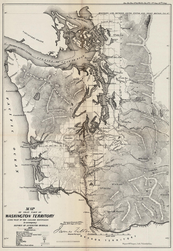
(Image courtesy of Washington State Archives)
When you look at maps of Washington nowadays, you see a state that is crisscrossed with freeways, highways and railroads, one where cities and towns dot so much of the landscape.
That wasn’t the case in 1857, when Washington was in its early years as a mere territory and 32 years away from statehood. Back then, very few towns existed. In fact, rivers, Puget Sound and the coastline were the geographical features that stood out.
Curious to know how cartographers viewed Western Washington in 1857? Look no further than this 1857 map of the western part of the fledgling territory. The map was compiled by the Surveyor General’s Office from land and coast surveys and information derived from the earliest settlers and the military stationed in Washington Territory. It shows Indian reservations, prairies, swamps, saw mills, roads and trails. The goal of the survey was to classify the usefulness of all the new lands, primarily for the eventual sale to settlers, and secondarily to determine its usefulness to the government for military or transportation purposes. It was one of the maps provided to citizens and emigrants seeking a home in the distant frontier.
The map is the first of our three March Archives Treasures. The series highlights many of the rare and interesting items and collections found in our State Archives. More to come this week!