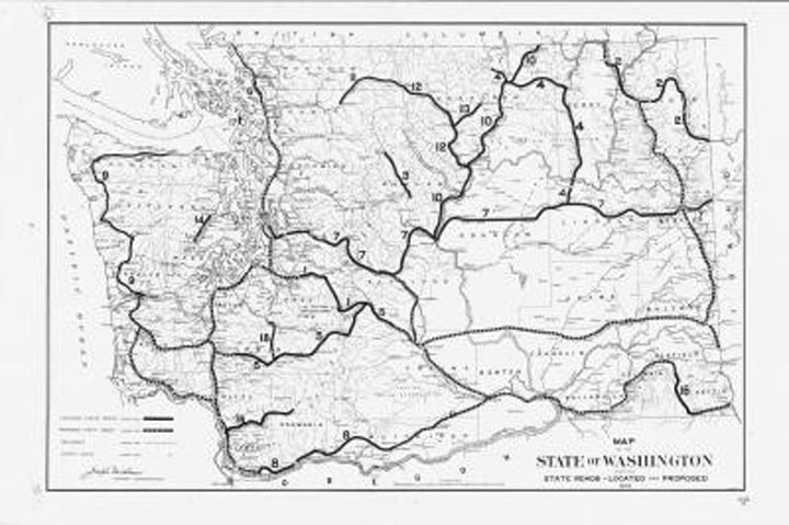
From the Digital Archives: 1909 Washington highway map
Nowadays, when we look at a highway map of Washington, we see a complex web of gold, red and black lines crisscrossing the state. But it wasn’t always this way. In the early 1900s, highways were a rarity in the Evergreen State. Probably because cars and trucks were rarities as well, considering that the automobile had just been invented. This 1909 map displays Washington’s located and proposed highways, railroads (the dominant form of transportation then) and county seats. The map…