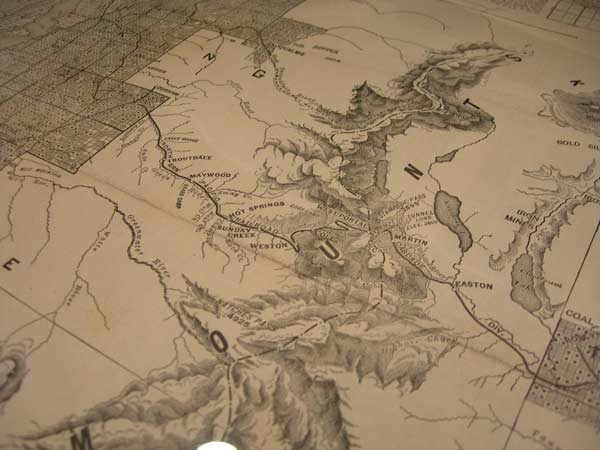
Library jewels contender #2: Stampede Pass railroad map
(Maps courtesy of Washington State Library)
Before automobiles and highways came along, trains were the predominant mode of long-distance travel in Washington and beyond. But the rugged Cascades were a barrier preventing a direct rail route connecting Puget Sound to the rest of the U.S. That changed with one of the most arduous construction projects ever completed in Washington – the building of the Northern Pacific’s route through Stampede Pass, the first of three rail crossings over the mountain range (routes across Stevens and Snoqualmie passes were built later).
The second State Library jewel contestant for March is a rare map from 1888 showing the Northern Pacific railroad winding through the Cascades, about the time that the Stampede Pass tunnel was finished.
The first contestant is the scrapbooks of former Congressman Albert Johnson. The monthly blog series spotlights three of the many interesting, historical or downright cool items found in the State Library. We’ll feature the third contender early next week and then open the online poll so you and others can vote on your favorite.
This story in HistoryLink.org details the opening of the Stampede Pass railroad tunnel on May 27, 1888:
“The tunnel, which crosses from King County into Kittitas County, opens a new railroad gateway from Puget Sound to the East.
“This tunnel is 1.8 miles long, at the time the second longest in the country. The 28-month process of building the tunnel began on February 13, 1886.
“Before the Stampede Pass tunnel, the process of scaling the Cascades by train was an ordeal involving a series of switchbacks. The completed tunnel allowed for relatively easy passage.
“The tunnel, initially serving the Northern Pacific Railroad, made Seattle and Tacoma primary contenders for economic dominance of the Pacific Northwest.”
Here is a map showing the land grant of the Northern Pacific Railroad Co. in Western Washington and Northern Oregon that was updated in 1892.
Go here to see the State Library’s rare map collection for Washington, as well as other online catalogs.
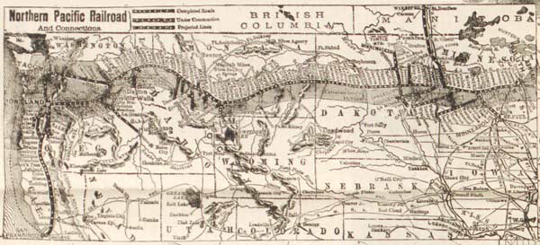
Below is an 1892 map showing the Northern Pacific Railroad system from Minneapolis to the Pacific Coast.

