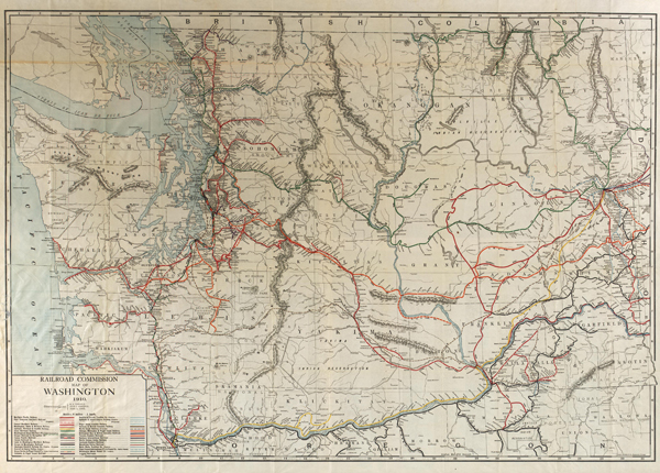
Archives treasure #3: Railroad maps, 1880s-1980s
There was a time, before highways were so commonplace, when railroads dominated U.S. transportation. In fact, the American rail network in the 1910s was more than 250,000 miles of track, far more than the roughly 140,000 miles existing today nationwide.
The third and final Archives treasure for December reflects that golden era of railroads in Washington and the rest of the U.S. It’s a collection of more than 4,000 railroad maps held by the State Archives. The statewide map above is from 1910.
These maps document the growth and settlement of the state, from the first railroad along the Columbia River in 1851, to Seattle’s first railroad 20 years later, to today’s passenger and freight lines. The largest set of maps, Right of Way Maps, detail routes of every railroad in the state, prepared for the Department of Revenue for taxation purposes and includes maps of the Northern Pacific Railroad, Great Northern Railway, Cascade and Columbia Railroad, Pacific Coast Railroad, Camus Prairie Railroad, Puget Sound and Pacific Railroad, Blue Mountain Railroad, Tacoma, Eastern Railroad, Chehalis Western Railroad, Oregon Trunk Line, Union Pacific Railroad, Spokane International Railway, Blue Mountain Railroad, and the Spokane, Portland and Seattle Railway.
We’ll launch this month’s Archives treasure online poll after Christmas, so watch for it and choose your favorite.
