Washington’s lost county
 Some state history buffs might know this, but betcha most folks don’t: Washington actually “lost” a county during its territorial years.
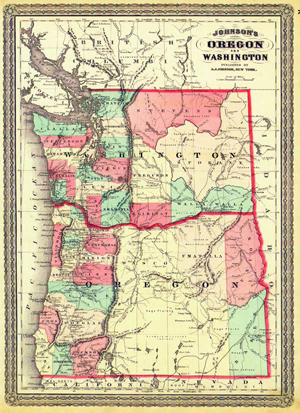
On January 23, 1863, the Washington Territorial Legislature created Ferguson County. It encompassed what is now Yakima and Kittitas counties. However, no county government (not even a county seat) was established in Ferguson as there were less than 100 settlers living within its borders, and they didn’t see the need for a county government. (Go here to see a Washington Territory map from the 1860s that features Ferguson County.)
On January 18, 1865, the Territorial Legislature dissolved Ferguson County. Bye, Fergie. However, the void in that part of Washington didn’t last long. Three days later, the Territorial Legislature approved an act creating Yakima County. In 1883, Kittitas County was carved out of Yakima County.
When Washington became a state in 1889, most of its 39 counties were already in existence. Only five – Ferry, Benton, Chelan, Grant and Pend Oreille, all in Eastern Washington – were established after statehood.
Would you believe that eight counties were around before Washington even became a territory in 1853? Even harder to believe is that Pacific County, located in the southwest corner of our state, came into existence before mighty King County. Back in the early 1850s, sea travel was by far the fastest way to make long trips, and Pacific County was very accessible by ship. Meanwhile, the rail line linking Washington with the rest of the U.S. was still many years away.
The State Archives has a document that lists the chronological order of Washington’s counties, from the oldest (Clark, 1845) to the youngest (Pend Oreille, 1911). Go see the exact date when your county became a county!
Map courtesy of Washington State Archives