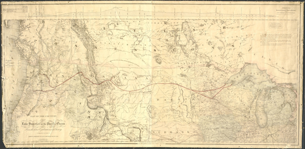
June Library Jewel #1: 1867 map from Lake Superior to Pacific
(Image courtesy of Washington State Library)
If you’re into maps, the State Library is for you. It has a collection of Metsker maps of each Washington county, topographical maps, national forest, park and trail maps, nautical charts, and an outstanding rare maps collection.
One is this 1867 map of the country from Lake Superior to the Pacific Ocean. For those who need a cartographical refresher course, that part of the nation stretches from what is now Minnesota to the Dakotas, Montana, Wyoming, Idaho, Oregon and – drum roll, please – Washington.
The map, found in the library’s Rare Maps Collection, was prepared at Coltons Geographical Establishment in New York. It accompanied a report by Edwin Ferry Johnson, who was Northern Pacific Railroad’s chief engineer during this era. This map shows the NP Railroad route as envisioned in 1867, with the terminus placed in Seattle. Keep in mind that the first wagon road over Snoqualmie Pass was still in the process of completion. Upon completion in May 1888, the railroad route ended not in Seattle, but Tacoma.
