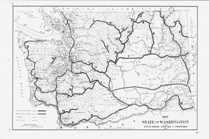
From the Digital Archives: 1909 Washington highway map
Nowadays, when we look at a highway map of Washington, we see a complex web of gold, red and black lines crisscrossing the state.
But it wasn’t always this way. In the early 1900s, highways were a rarity in the Evergreen State. Probably because cars and trucks were rarities as well, considering that the automobile had just been invented.
This 1909 map displays Washington’s located and proposed highways, railroads (the dominant form of transportation then) and county seats. The map reveals there was no established state highway yet for what we now call the I-5 corridor, only a proposed highway. That meant trains were still by far the fastest way for Seattleites to travel south to Portland or north to Bellingham.
The map shows there was a highway stretching east from Seattle and over Snoqualmie Pass to Cle Elum. You’d think the highway would continue to Ellensburg, right? Nope. It veered north over Blewett Pass before winding its way to Wenatchee, Waterville and eventually Spokane. It’s worth noting there was a proposed road from Cle Elum to Ellensburg and what was then North Yakima.
As you study the map, you realize that some few Washington cities of today weren’t around back then, including Bellevue, Federal Way, Issaquah, Lacey, Longview, Moses Lake and Richland. But you also notice a plethora of very small towns dotting the 1909 map that you don’t find on current versions: Eagleton, Kosmos, Wellington, Billington and Wheatland, among others.
The map is found in the General Map Collection, 1851-2005 on the State Digital Archives website.