1888 map shows a much different WA
If you really want to get a sense of how Washington has changed since statehood, just look at an old map.
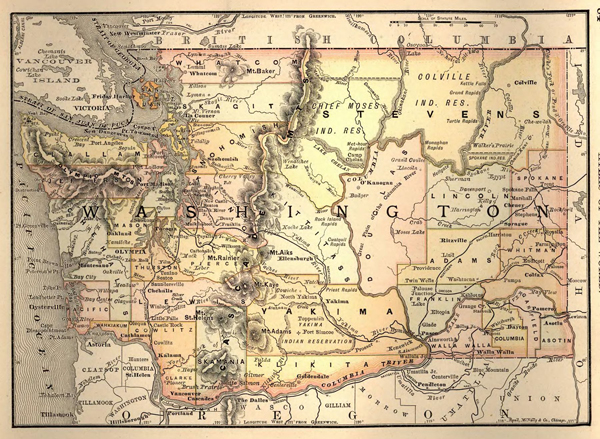
This 1888 map, created by Rand McNally & Co., shows Washington Territory one year before it became the 42nd state. The map, found in the combined digital map collections for the State Library and State Archives, features cities and counties that existed back then. (Stevens County was enormous, covering what is now Okanogan, Ferry and Pend Oreille counties as well as the current Stevens.) You’ll see many small towns that no longer exist today. (Where have you gone, Meadow?) You’ll also realize that several well-known cities today, like Bremerton, Bellevue, Kent, Richland and Pullman, don’t appear on this map.
The collection of historic maps is just one of many digital collections and references that the State Library provides.