


The Historic Background of the Oso Mudslide

2014 Oso mudslide
The story of the Oso mudslide is being followed around the nation. What many people don’t realize however is that this area was hit by a similar mud slide in 1951, thankfully non-fatal. The pictures accompanying this post show an aerial view of the recent mudslide which is slightly to the west of the 1951 slide, the area of the slide in 1949 and a plan of where the 1949 Hazel slide occurred . (The two early pictures are found in the first document on the list below)
As interest in the historiography of the Oso Mudslide grows, the Washington State Library Digital and Historic Collections Unit has identified and made available online the following titles:
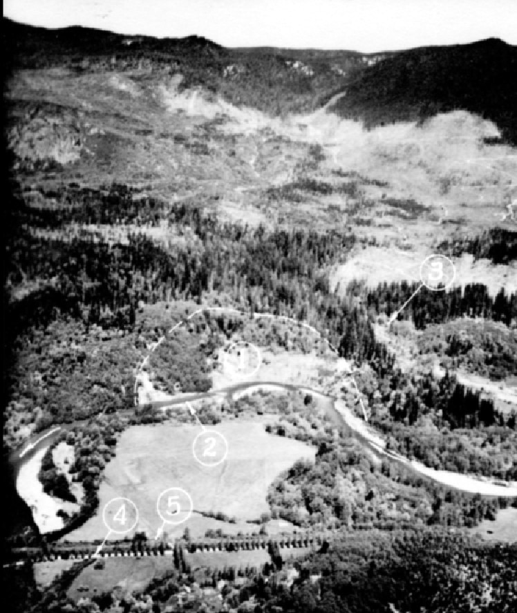
Hazel Mudslide area 1949
Report on slide on North Fork Stillaguamish River near Hazel, Washington [1952]
Stillaguamish slide study : summary of data obtained by Research Division during 1952 , [1953?]
Hazel/Gold Basin landslides : geomorphic review draft report [1999]
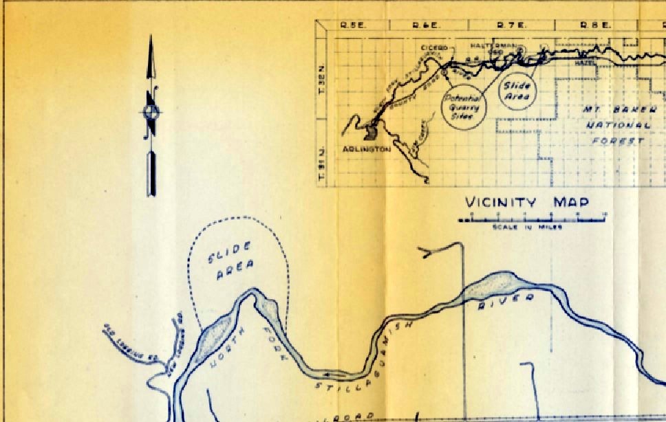
Plan- Hazel Mudslide
We will continue to digitize background material on this area as we can and make it available for online viewing.
You can follow any responses to this entry through the RSS 2.0 feed. Both comments and pings are currently closed.